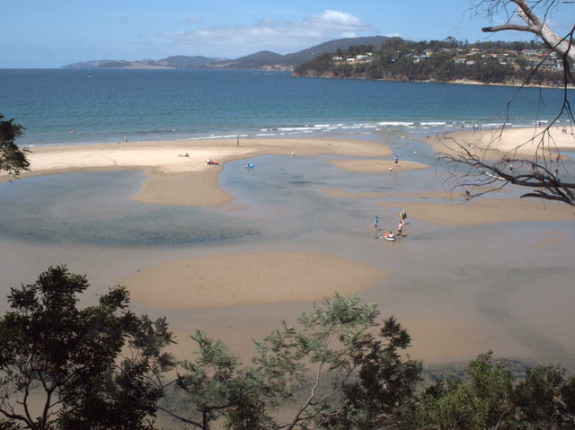
Today was too lovely a summer day not to get out and enjoy, so I set off for Kingston Beach. I had vague memories of having walked the Alum Cliffs track around 15 years ago, and all I recalled was that there were lots of sections that were closed for safety reasons. On that occasion I had come from the Taroona end, but the walk is now most often commenced at Tyndall Beach at Kingston (aka the ‘dog beach’).

The track starts just the other side of the bridge across Browns River. Given the temperature was set to get to the high twenties, I was a bit concerned about both climbing and exposure to hot sun, but I needn’t have worried. The track is well made and climbs gently from the beach, aided by a series of zig zags to ease the effort of climbing. The track is through light forest for most of its length, and the trees afford plenty of shade.
There are also plenty of bench seats along the way, and several picnic tables, so it’s clearly popular with locals, plenty of whom were out on the track today, some walking, and not a few taking it at a full jog (one chap who passed me going over the bridge at Browns River was already coming back by the time I was half way to Taroona).
The track passes between the houses of Bonnet Hill and the edge of the cliff, passing down into gullies on several occasions. One of these was very nearly a rainforest glade (and possibly would be in damper conditions than the extended dry spell we’ve had), with Dicksonia antarctica and myrtle abundent, even through the creek bed looked pretty dry.
The track concludes on a headland at the end of Taronga Road, which enters the Channel Highway near the Shot Tower. The lookout offers views of Taroona’s lovely beach, and also one of the few glimpses of the actual cliffs themselves available from the track itself.
A further path is signed to the Shot Tower from this point, although I didn’t take this path on this occasion as I’d left my vehicle at Kingston. The path also started descending quite steeply into what appears to be a deep gully between the Taronga Road area and Taroona itself on the far side. Thus access to the charms of Taroona’s beaches would appear to be via the Shot Tower, Channel Highway for a short section, and various side streets, rather than through the bushland.
Resources
- Please note that this Alum Cliffs Track should not be confused with another Alum Cliffs Track in Northern Tasmania near Deloraine.
- The Alum Cliffs Track is on the Greater Hobart Trails website. Another, the Brickfields Track, links the Alum Cliffs Track to the Shot Tower at Taroona.
- The Kingborough Council website has a handy downloadable leaflet with a map and notes for the Alum Cliffs Track
- The Taroona Foreshore Track is worth exploring, on its own or as an extension to this walk, if you have the energy and/or the chance of organising a car shuffle or other transport.
Update – January 2017
On a recent visit to the area, I discovered there is indeed a well-made track leading from Hinsby Beach, via a short stetch along Wandella Avenue, then via a bush track to the Shot Tower. I’ve not walked it all yet, but it appears well-signposted and well made, although for some reason it isn’t mentioned in any of the normally reliable online resources on local tracks and trails. Perhaps it is a recent addition, or recently refurbished. The start of the track from Hinsby Beach to Wandella Ave is a bit overgrown, but it soon opens out to an easy walking track for the 500m or so to Wandella Ave, and it is great that it’s not necessary to detour along the very narrow section of the Channel Highway around the Shot Tower to complete this walk.
Map
I’ve added my own line to represent the approximate route of the track from Wandella Avneue Taroona to the Shot Tower, as I couldn’t find any reference to it in the usual resources. The rest of the Alum Cliffs Track (from Tyndall Beach to the Shot Tower) is imported from the Greater Hobart Trails website (see link above).